By Michael Lanza
Want to hike the most remote and wild long-distance trail in the Lower 48? The Idaho Wilderness Trail stretches for 296 miles across three central Idaho wilderness areas that comprise nearly four million acres. If these three wildernesses were contained within one national park, it would be America’s third largest and the biggest outside Alaska. This article offers a primer on the IWT and links to digital maps of its four stages.
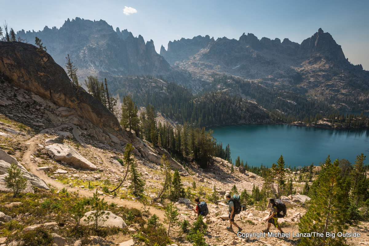
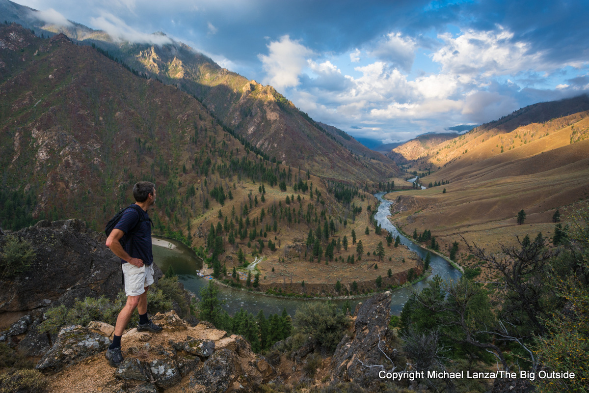
From north to south, the IWT traverses the 1.3-million acre Selway-Bitterroot Wilderness, which by itself is larger than many national parks, including Yosemite, Grand Canyon, and Glacier; the nearly 2.4-million-acre Frank Church-River of No Return Wilderness (aka “the Frank”), largest in the Lower 48 and bigger than Yellowstone; and the 217,000-acre Sawtooth Wilderness, protected as a primitive area since 1937, among the first places protected in The Wilderness Act of 1964, and now Idaho’s best-known and most beloved mountain range for its jagged peaks and hundreds of alpine lakes.
Nearly 350 miles long when including three remote road sections—where backpackers may be able to catch rides—the IWT extends from its northern terminus at Wilderness Gateway campground on US 12 on the edge of the Selway-Bitterroot Wilderness in North Idaho to its southern terminus on the outskirts of the tiny town of Atlanta, on the southern edge of the Sawtooth Wilderness. It can be hiked as four distinct stages or thru-hiked in a month or less.
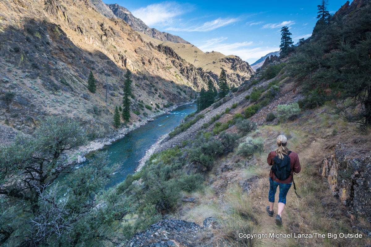
Born several years ago when I brought the concept of it to the Idaho Conservation League, which embraced the idea and collaborated with me to create it using existing trails, the IWT spans a vast realm of mountains and canyons divided by just one rural highway (ID 21 outside the small town of Stanley) and two remote dirt roads. It crosses mountain passes over 9,000 feet and meanders below peaks rising over 10,000 feet; follows three designated wild and scenic rivers, the Middle Fork of the Salmon, Main Salmon, and the Selway; and traces the shores of innumerable alpine lakes below dramatic spires from the Bighorn Crags in the Frank to the Sawtooths.
It passes through pristine backcountry that is home to mountain goats and bighorn sheep, elk and moose, black bears, and hundreds of wolves—a population estimated to be at least seven times as many as live in Yellowstone.
Perhaps most uniquely, the IWT offers the kind of solitude one cannot find on most long-distance trails. In fact, many backpackers have never even heard of the wilderness areas the trail traverses. I’ve backpacked the John Muir Trail and parts of the Pacific Crest Trail, Appalachian Trail, and other long-distance footpaths. The IWT far eclipses them for solitude.
Like what you’re reading? Sign up now for my FREE email newsletter!
Thru-hiking the IWT poses logistical challenges in some ways more challenging than other long-distance trails. Besides its remoteness, those include:
- The trail crosses mountains in each of its four stages and deep canyons in between the mountains. A thru-hike must be undertaken in the summer or early fall to avoid snow in the mountains, but that means dealing with heat in the lower canyons.
- Arranging a shuttle between the northern and southern ends of the IWT for a thru-hike—or even between the northern and southern ends of any stage(s) of the trail—is complicated by very limited road access and the sheer size of these wilderness areas. Two of the three roads the trail crosses are gravel and quite remote and the driving time between the Wilderness Gateway Campground on US 12 at the IWT’s northern end and the tiny town of Atlanta, Idaho, at the IWT’s southern end (reached via good but somewhat slow gravel roads), is over eight hours one-way.
- Resupply opportunities are scant and far apart. Unlike more-established long-distance trails like the JMT, PCT, and AT, there are not yet established places where one can resupply along the IWT.
Perhaps most challenging, some sections of the IWT follow trails that have not been maintained in years—or never maintained—especially the IWT’s northern sections in the Selway-Bitterroot Wilderness. Anyone considering a thru-hike or a backpacking trip on any section of the Idaho Wilderness Trail is strongly advised to read through the very detailed and well-researched blog posts written by my friends Tom and Will Gattiker, who thru-hiked the IWT in September and October 2022. Will’s report focuses on critical logistical details and recommends variations off the IWT to avoid abandoned/unmaintained trails: safesexandgoretex.com/2022/11/idaho-wilderness-trail-nitty-gritty.html. Tom’s report is more of a travel log about the experience: click here.
See my tips and more information on backpacking the IWT in my story, “America’s Newest Long Trail: The Idaho Wilderness Trail,” and the comments at the bottom of that story, where some backpackers who’ve hiked the trail share helpful, specific details about it See also my Custom Trip Planning page to learn how I can help you plan a thru-hike of the entire Idaho Wilderness Trail or a backpacking trip on one of its stages as well as any trip you read about at this blog.
Want to hike the Idaho Wilderness Trail?
Click here for expert, detailed advice you won’t get elsewhere.
Idaho Wilderness Trail Maps
See an overview map of the Idaho Wilderness Trail at https://drive.google.com/file/d/11GOZEV1ufser-wbHh9SniDkdXeJKyN2Q/view?ts=5ce5d90e. Mapping the IWT on gaiagps.com, the IWT measures 349.6 miles, including 296 total official trail miles divided into four stages and three road sections that total 53.6 miles.
These are links to the four IWT stages maps on gaiagps.com:
Gaia map of IWT Stage 1
Gaia map of IWT Stage 2
Gaia map of IWT Stage 3
Gaia map of IWT Stage 4
Will Gattiker, who thru-hiked the IWT with his father, Tom, in 2022, created a map of the route they took, including some variations necessitated by wildfires and poor trail conditions, at caltopo.com/m/R171T.
Existing print maps that cover parts of the IWT include:
- The Cairn Cartographics Selway-Bitterroot Wilderness North Half and South Half (two maps) cover that wilderness area, cairncarto.com.
- The Frank Church River of No Return Wilderness South Half and North Half maps are folded paper maps that provide a good overview of the wilderness, showing trails, but are large, not tearproof or waterproof, and unwieldy to use in the backcountry. See info on buying these maps at fs.usda.gov/detail/scnf/maps-pubs/?cid=fsbdev3_029527. I think you might find those maps on Amazon and elsewhere.
- Trails Illustrated Sawtooth National Recreation Area map no. 870. It has convenient mileage distances marked for trail segments and good detail for backpacking.
The Idaho Wilderness Trail will give you a backpacking experience like no other.