By Michael Lanza
Is it possible to find solitude backpacking in a national park as popular as Glacier? The answer is an unequivocal yes—even in Glacier’s relatively short peak season of mid-July through mid-September. And the strategies for doing so are remarkably simple and will not compromise the quality of your experience in other ways—in fact, encountering fewer people only increases the chances of encountering wildlife. This article describes five backpacking trips where you are virtually guaranteed to enjoy serious solitude in Glacier National Park.
For backpackers, Glacier delivers one of the most inspiring and unique wilderness experiences in the country, with scenery almost unmatched and a high likelihood of spotting megafauna seen in few places in the Lower 48, including mountain goats, bighorn sheep, elk, moose, and black and grizzly bears. I have enjoyed stretches of solitude on each of the several backpacking trips I’ve taken in Glacier over the past three decades—including the 10 years I spent as the Northwest Editor of Backpacker magazine and even longer running this blog. Most recently, I backpacked a variation of much of the Continental Divide Trail through the park, one of the trips described below.
This story describes 10 backpacking trips that deliver a high degree of solitude over most of their route—and a few represent the very best backpacking trips in Glacier, while also striking an optimum balance between five-star scenery and a high solitude quotient. This article really presents a list of the best multi-day hikes in Glacier, with a focus on avoiding the huddled masses most of the time. Each writeup below provides details on the overall degree of solitude on that trip and where you’ll find it, plus links to full stories at The Big Outside (which require a paid subscription to read in full; in this story, too, the first six trip descriptions below are free for anyone to read and the last four trips require a subscription to read).

Key Details About Glacier
A Glacier backpacking permit is one of the hardest to get in the National Park System. Glacier holds two early-access lotteries at recreation.gov/permits/4675321, on March 1 for large groups of nine to 12 people and on March 15 for standard groups of one to eight people. General reservations open for all remaining backcountry campsites on May 1, running through Sept. 30. Glacier makes 70 percent of backcountry campsites available for reservations and 30 percent of campsites available for walk-in permits no more than one day in advance. See “How to Get a Permit to Backpack in Glacier National Park” and “10 Tips for Getting a Hard-to-Get National Park Backcountry Permit.”
Full disclosure: Complete solitude is rare during summer because most available permits get used, but you can walk for hours, even on some popular trails that are farther from trailheads and see few or no people; and by avoiding the easily accessible, very scenic areas like Lake McDonald, Many Glacier, Logan Pass, St. Mary, and Two Medicine, which attract the most dayhikers and backpackers.
Go after Labor Day and you’ll probably see fewer people than in July or August. Keep in mind that you could certainly see a snowstorm in September (or even in late August). Check the forecast before you head out, and have good base layers, insulation, and rain shells, waterproof-breathable boots, a warm bag, and a good tent. Snow at that time of year tends to melt away as soon as the sun comes out again, but be ready for any weather. And certainly carry pepper spray in grizzly country.
Get my expert e-books to the best backpacking trip in Glacier
and backpacking the Continental Divide Trail through Glacier.

See my feature stories about a 90-mile backpacking trip in northern Glacier, part of which is a 65-mile hike that I consider the best backpacking trip in Glacier; a 94-mile traverse of Glacier mostly on the Continental Divide Trail; and my family’s three-day backpacking trip on Glacier’s Gunsight Pass Trail. (Those stories require a paid subscription to read in full; in this story, too, the first six trip descriptions below are free for anyone to read and the last four trips require a subscription to read.)
As I suggest in the very first of my “12 Expert Tips For Finding Solitude When Backpacking,” the best strategy for finding solitude in a popular park like Glacier is to head to the less well-known areas of the park. Large parts of each trip described in this story do exactly that, and every one of them has Glacier-caliber natural beauty and a high likelihood of seeing wildlife.
Want to explore Glacier on dayhikes? See “The 10 Best Dayhikes in Glacier National Park” and “The 8 Best Long Hikes in Glacier National Park.”
Tell me what you think of these trips, or offer your own, in the comments section at the bottom of this story. I try to respond to all comments.
Find your next adventure in your Inbox. Sign up now for my FREE email newsletter.

Chief Mountain to Many Glacier
Distance: 20 miles
Solitude: Virtually the entire hike except south of the Iceberg Lake spur trail.
Arrange a shuttle from Many Glacier to the Chief Mountain customs station on the Canadian border, and hike from there up the Belly River Trail and Ptarmigan Tunnel Trail back to Many Glacier; an awesome 20-mile trip over two to three days. If you can, add the 8.6 miles (but not much elevation gain) out-and-back to Helen Lake, and camp there; the trail ends there, so you could have the place to yourself, and the lake sits in a deep mountain cirque below the soaring cliffs of Ahern Peak.
Even though Iceberg Lake is a popular dayhike, the short side trip out to it is well worth the time and putting up with the crowds—although dayhikers are generally there mostly during the middle hours of the day. See photos from these areas in my feature stories “Déjà vu All Over Again: Backpacking in Glacier National Park” and “Wildness All Around You: Backpacking the CDT Through Glacier.”
After Glacier, hike the other nine of “America’s Top 10 Best Backpacking Trips.”

Bowman Lake to Kintla Lake
Distance: 37 miles
Solitude: The entire hike except within a few miles of Bowman or Kintla Lake.
The first backpacking trip I did in Glacier was a nearly 37-mile, point-to-point hike from Bowman Lake to Kintla Lake in the park’s northwest corner, via Brown Pass and Boulder Pass. It’s a beautiful hike in a less-accessible corner of the park, going from forest and lakes to alpine terrain with views of peaks and glaciers and likely sightings of mountain goats.
The three high camping areas along the route—Brown Pass, Hole in the Wall, and Boulder Pass—are all excellent, with views of the peaks in that corner of the park. I rode my mountain bike between the trailheads instead of arranging a vehicle shuttle; I recall it being less than an hour from Kintla (where I left our car) downhill to Bowman.
I can help you plan your Glacier hike or any trip you read about at my blog. Find out more here.

Traverse Glacier on the CDT
Distance: about 90 miles, with shorter options
Solitude: Most of the trip, except the Many Glacier and Two Medicine areas and within dayhiking range of the Going-to-the-Sun Road.
The Continental Divide Trail crosses Glacier from north to south (but you can hike it in either direction), traversing some of the richest scenery and loneliest corners of the park—as well as, to be sure, a few popular areas where you’ll see more hikers, like Many Glacier, the southwest end of St. Mary Lake, and Two Medicine. Still, for the price of those short periods within range of dayhikers, you’ll enjoy the jaw-dropping vistas in those marquis spots while spending most of this gorgeous trip just in the company of your companions.
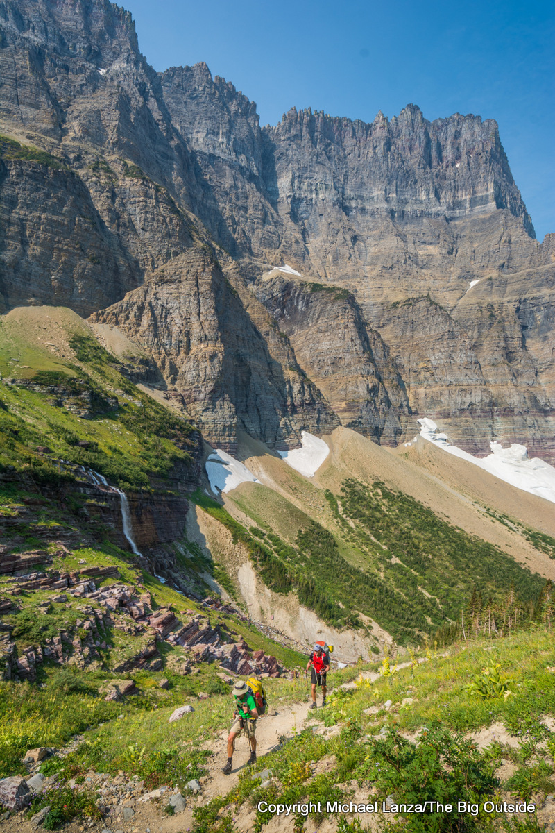
The CDT through Glacier has a primary and an alternate route. I wrote about combining parts of both on a 94-mile traverse I designed to hit much of the park’s best backcountry, including the high, alpine trail from Pitamakan Pass to Dawson Pass that’s among the best high-level hikes I’ve ever done (see lead photo at top of this story). Over six days, we saw bighorn sheep, mountain goats, black bears, moose, and a griz, and heard elk bugling almost every morning and evening (it was September). Many shorter trips on pieces of the CDT are possible.
I wrote about two slightly different variations of this hike in my feature stories “Déjà vu All Over Again: Backpacking in Glacier National Park” and “Wildness All Around You: Backpacking the CDT Through Glacier.” My downloadable e-guide “Backpacking the Continental Divide Trail Through Glacier National Park” explains all you need to know to plan and execute that trip—and it describes several shorter alternative itineraries that hit parts of Glacier that provide the best opportunities for solitude.
Read all of this story and ALL stories at The Big Outside,
plus get exclusive gear discounts and a FREE e-guide! Join now!

Flattop Mountain
Distance: 28 to 31.5 miles
Solitude: Much of the trip, except the southern Highline Trail, Granite Park, and anywhere close to the Going-to-the-Sun Road.
This three- to four-day hike incorporates a piece of the exceptional Highline Trail with another high trail that sees far fewer hikers, starting from a trailhead that sees much less demand for a wilderness permit than starting at Logan Pass or Many Glacier. Plus, the dayhiking crowds on the southern end of the Highline Trail diminish greatly beyond a few miles north of Logan Pass—and it’s hands-down one of the most spectacular trails in the park. (The lead photo at the top of this story was taken on the Highline Trail just north of the Fifty Mountain backcountry campground.) You can also take in the awesome vistas from Sue Lake Overlook and Ahern Pass, both reached on short spur trails.
Take the free park shuttle bus to The Loop, west of Logan Pass on the Going-to-the-Sun Road, and hike from there north on the less-traveled Flattop Mountain Trail to the Fifty Mountain backcountry campground, then return south on the Highline Trail to finish either at The Loop (28.1 miles total) or go all the way to Logan Pass (31.5 miles); I recommend the latter, but hike the busier section, the 7.6 miles from Granite Park to Logan Pass, in early morning to see fewer hikers.
See “5 Reasons You Must Backpack in Glacier National Park.”

Glacier’s Northern Loop
Distance: 52 to 65 miles
Solitude: Most of the trip, except the southern Highline Trail, Many Glacier area, and within dayhiking range of the Going-to-the-Sun Road.
The popular, 52-mile Northern Loop takes in some of the most scenic and best-known areas of the park, including the northern section of the Highline Trail, the Ptarmigan Tunnel, and Many Glacier. It also may be the park’s most sought-after permit, or certainly one of them. And yes, you’ll see plenty of dayhikers along some of this route and Many Glacier feels like a small town. A 65-mile variation of the Northern Loop that I’ve hiked—which I consider the best multi-day hike in Glacier—adds stunning Piegan Pass below the Garden Wall and the entire Highline Trail.

But long stretches of both options for this route still deliver a satisfying degree of solitude. As I suggest in tip no. 6 of my “12 Expert Tips For Finding Solitude When Backpacking,” go deeper into the backcountry and you will find solitude. On most of this hike, you’ll walk through remote parts of the park’s northern tier, occasionally encountering only other backpackers. You’ll also see some of the park’s finest wilderness lakes and high country. And you might not mind spending one “backcountry” night in the Many Glacier campground and gorging on a restaurant dinner and breakfast.
See my story “Descending the Food Chain: Backpacking Glacier National Park’s Northern Loop,” photos of part of this loop in my story “Déjà vu All Over Again: Backpacking in Glacier National Park,” and my expert e-book “The Best Backpacking Trip in Glacier National Park,” which covers all the details on planning that trip, including my tips on the best way to do it and best campsites.
Nyack Creek-Coal Creek Loop
Distance: 45 miles
Solitude: The entire trip except when near either trailhead.
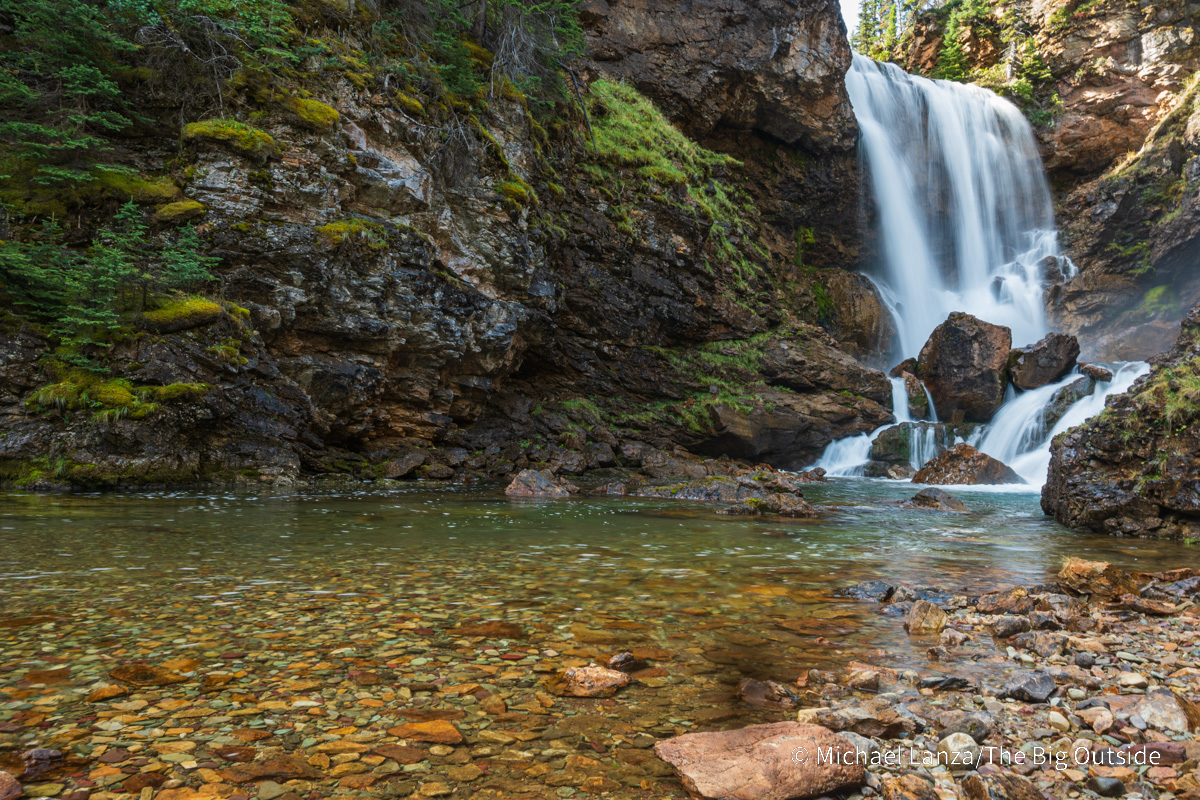
The approximately 45-mile Nyack Creek-Coal Creek loop, in the park’s much less-visited southwest corner, will deliver solitude, remoteness, and wildness in spades. Highlights of it are where Nyack Creek drops steeply over waterfalls through a narrow, rocky gorge; views of peaks on the Continental Divide along upper Nyack; Buffalo Woman Lake, which has a pretty waterfall and is ringed by mountains (Beaver Woman Lake is hard to reach—there’s no trail to it); and where the Coal Creek Trail passes through a large burned area with sweeping views of surrounding peaks.
Here on the west side of the Divide, the terrain is mostly less vertiginous than found in areas like Many Glacier, Logan Pass, and St. Mary, and much of this loop remains in forest; plus, sections of trail around Surprise Pass may be overgrown. There is a ford of the Middle Fork of the Flathead River, which can run high and fast in early summer, and several fords of Coal Creek, which is shallow; it may be more convenient to hike in water shoes or sandals for a while there.
Get the right gear for your trips. See “The 10 Best Backpacking Packs”
and “The 10 Best Backpacking Tents.”
See the two Glacier trips that rank among “America’s Top 10 Best Backpacking Trips,” “12 Expert Tips For Finding Solitude When Backpacking,” and all stories about backpacking in Glacier at The Big Outside. Note that most of those stories require a paid subscription to read in full.
Whether you’re a beginner or seasoned backpacker, you’ll learn new tricks for making all of your trips go better in my “How to Plan a Backpacking Trip—12 Expert Tips,” “A Practical Guide to Lightweight and Ultralight Backpacking,” and “How to Know How Hard a Hike Will Be.” With a paid subscription to The Big Outside, you can read all of those three stories for free; if you don’t have a subscription, you can download the e-guide versions of “How to Plan a Backpacking Trip—12 Expert Tips,” the lightweight and ultralight backpacking guide, and “How to Know How Hard a Hike Will Be.”
